About AeroMilBag
ARINC and GlobalNavSource have partnered to develop AEROMilBag - an EFB application for military flight personnel. AEROMilBag s paperless environment provides a cost-effective solution in a compact, lightweight package...
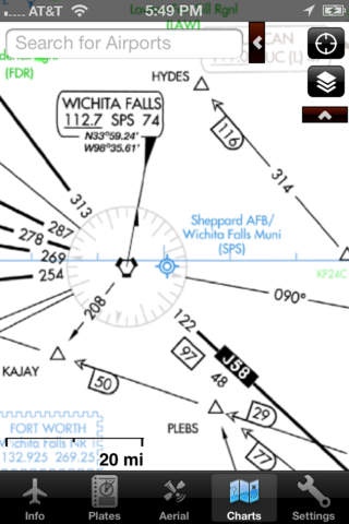
ARINC and GlobalNavSource have partnered to develop AEROMilBag - an EFB application for military flight personnel. AEROMilBag s paperless environment provides a cost-effective solution in a compact, lightweight package robust enough to meet the stringent requirements of the military and other governmental agencies. The database fully supports DoD Aeronautical Flight Publications (FLIP) as well as all FAA Publications. To access AEROMilBag, you need to be assigned an access code. Please contact
[email protected] if your command is interested in purchasing the app. Civilian pilots should download the GlobalNavSource EFB app instead. *****Focus on Design***** AEROMilBag is designed by military operators for military operations. Extensive field testing has demonstrated AEROMilBag s effectiveness in increasing aircrew situational awareness and reducing pilot workload. Human factors design considerations have resulted in an intuitive, easy to use application where all functions are just one touch away, making last minute runway or approach changes a breeze. AEROMilBag utilizes iPad's gesture-based interface which makes for aircrew friendly operations. * cache all charts, plates, and airport data for stand-alone in-flight use * fast, auto-complete airport search * quick-swipe between airport plates * pre-download upcoming data so you are ready to fly when you need to be * extensive worldwide facility and weather information *****Data***** DoD plates are provided in a database that covers the world. AEROMilBag provides seamless compilations of VFR and IFR chart sources, for the easiest chart-browsing experience. * IFR High * IFR Low * VFR Sectionals * VFR Terminal Area Charts Plates and charts are geo-referenced and provide GPS own-ship position and moving map capability. *****Updates***** Updates are a breeze. Data updates are handled in the background, while using the app, so useability is not disrupted. In addition, AEROMilBag caches upcoming plates and charts before they are needed, so you have everything available, in a stand-alone configuration, when you are ready to fly. Updates and data selection can be tailored to the unique mission of each user. Updates are accomplished wirelessly and only plates that change are updated. This greatly reduces bandwidth and speeds the update process in comparison to NACO based apps. *****Weather***** * METARs and TAFs - view information from thousands of weather stations around the world * Chart overlays - display METAR weather layers on all chart types
Requires iOS 4.3 or later. Compatible with iPhone, iPad, and iPod touch.
Previous Versions
Here you can find the changelog of AeroMilBag since it was posted on our website on 2016-09-27 15:14:06.
The latest version is 2.7 and it was updated on 2024-04-22 19:16:27. See below the changes in each version.
AeroMilBag version 2.7
Updated At: 2011-10-25
Disclaimer
Official App Store Link
We do not host AeroMilBag on our servers. We did not scan it for viruses, adware, spyware or other type of malware. This app is hosted by Apple and passed their terms and conditions to be listed there. We recommend caution when installing it.
The App Store link for AeroMilBag is provided to you by apps112.com without any warranties, representations or guarantees of any kind, so access it at your own risk.
If you have questions regarding this particular app contact the publisher directly. For questions about the functionalities of apps112.com contact us.